A multi-year roadkill survey on US 64 is setting a baseline for the wildlife crossings needed to protect North Carolina’s wild red wolves and their wild neighbors.
A Three-Year Survey Through Red Wolf Territory
Every weekday, Jesse Moxley and Nathan Tabor set out to drive the same 30-mile stretch of North Carolina highway. Their commute starts with the sun just an hour above the horizon, part of a three-year roadkill survey shaping plans for new wildlife crossings along the highway.
US 64 provides the main thoroughfare for residents and tourists alike to travel to the famous Outer Banks, a narrow strip of islands off the coast of the state. To reach the islands, 64 crosses through the Alligator River National Wildlife Refuge, a rich mix of wetlands, swamp forest, and marsh supporting a biodiverse array of plants and wildlife — including the core range for the world’s only wild population of red wolves.
Highways and wildlife don’t mix well. For nearly two years, the team’s surveys have documented where different wildlife species are killed on US 64, along with an adjacent stretch of the much quieter US 264.
For red wolves, the need for new crossings is especially urgent. Fewer than 25 adult wolves remain in the wild, and dead wildlife on the roadway can lure wolves on the promise of a quick meal, making them vulnerable to vehicle strikes.
 Ron Sutherland
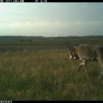
 Red wolves, photographed in Alligator River National Wildlife Refuge in 2025.
Black bears are vulnerable to the roadway, too. Nearly half of the 40 wildlife-vehicle collisions on U.S. 64 between 2021 and early 2026 reported by the North Carolina Department of Transportation involved a bear.
Thanks to concerted, long-term efforts to address the plight of wildlife in the region, help is on the horizon. In 2024, NCDOT received a $25 million federal grant to design and install a series of wildlife undercrossings for an especially deadly stretch of US 64. NCDOT’s application was made possible when Wildlands Network and the Center for Biological Diversity contributed $4 million in private matching funds, raised from thousands of donors. Construction on the crossings and fencing could begin as early as 2028.
Roadkill survey data is being used to highlight hotspots for various species and to support the creation of the new wildlife underpasses.
Moxley said that while witnessing slain wildlife is disheartening, he’s buoyed by the hope that the data will be used to inform the construction of crossings that improve wildlife’s chances of survival, and to evaluate the crossings’ success.
“Knowing that it’s going toward a project, that potentially our data will be used to show how much a crossing is working — and hopefully as motivation to get further crossings in — definitely helps for me,” Moxley said.
 Ron Sutherland
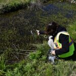
Field technician Nathan Tabor out on a morning survey to document roadkilled wildlife within the refuge.
 Ron Sutherland
Salinity measurements offered another way to understand where amphibians were being struck by vehicles.
The Lifesaving Effects of Documenting Roadkill
One morning, as the team drove to their survey starting point, a yearling black bear darted across US 264. The highway intersects US 64 and is the easternmost part of the survey route. The bear survived the crossing, and disappeared into the vegetation, out of sight.
But five minutes later, when they set out north to begin the morning’s survey, they saw what appeared to be the same young bear dead on the roadway.
“It must have tried to cross again and got hit,” Tabor said. “We see stuff like that occasionally, and it’s really upsetting. But hopefully, this work that we do here can prevent that happening as frequently, and — if I can be super hopeful — mostly stop it altogether.”
In addition to informing where to place crossings, documenting roadkill in the area provides life-saving benefits. When staff see roadkill, they remove it from the roadway so that it doesn’t attract scavengers, including red wolves and other wildlife.
 Ron Sutherland
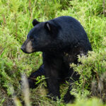
 A black bear spotted within Alligator River National Wildlife Refuge. Bears accounted for nearly half of NCDOT-reported wildlife-vehicle collisions on US 64, from 2021 to early 2026.
And in the case of large roadkill that they can’t move by themselves, like the yearling bear, staff can alert the U.S. Fish and Wildlife Service to relocate it to an area where it can be scavenged safely, away from the highway.
On a highway that was once the deadliest road for red wolves, that protocol makes a crucial difference. A month ago, a Wildlands Network technician found a wolf scavenging another bear carcass near US 64. Staff worked with the U.S. Fish and Wildlife Service to steer the wolf to safety and with NCDOT to clear the remains.
In the nearly two years of our surveys, only one red wolf has been killed by a vehicle strike on US 64, compared to 12 wolves killed on roads from 2020-2024.
“Knowing that it’s going toward a project, that potentially our data will be used to show how much a crossing is working — and hopefully as motivation to get further crossings in — definitely helps for me.”
– Jesse Moxley, Wildlands Network Field Technician
A Clearer Picture of Impact on Wildlife
With nearly two years of data in the books, we have a clearer picture of the types of wildlife affected by vehicle collisions near the refuge, and where the collisions occur.
When the team spots a dead animal, they pull over, take photos, identify the specimen, record the location, and remove it from the road.
Over 22 months, staff have recorded 7,214 animals representing 155 species. Animal categories are snakes, birds, mammals, frogs, turtles, and others.
That tally dwarfs NCDOT’s official crash reports, which log only the collisions large enough for a driver to report — mostly bears and deer. Neighboring Virginia has found that official figures like these can undercount actual deer-vehicle collisions by a factor of up to 8.5, since most incidents, especially involving smaller animals, are never reported.
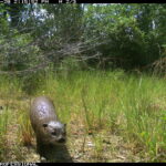
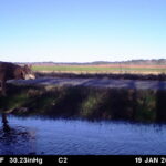
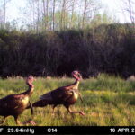
Camera traps set up by Wildlands Network within the Red Wolf Recovery Area captured a range of species that stand to benefit from a crossing on US 64. The abundance of wildlife in the images also offered a counter to a persistent claim: that wolves are driving down game populations.




The most common snake species found in the survey so far is the banded water snake, followed by the black swamp snake, a North Carolina species of special concern.
The team has detected 12 species of frogs, with the southern leopard frog and American bullfrog being most common.
Staff have recorded 77 species of birds. About half of the birds logged are yellow-rumped warblers. Following some snowstorms, the team has recorded more than 100 dead yellow-rumped warblers in a single day.
Of the mammals, they have counted 716 total animals representing 27 species. The most common is the Virginia opossum.
The team has detected 1,554 turtles across nine species. Sometimes, the turtles found are alive, and if they’re attempting a road crossing, staff can move them to where they’re headed, out of harm’s way.
The “others” category includes fish species, which of course aren’t actually trying to cross the road. One of the most common is a commercially-fished species that likely fell off of a truck in transit. For other fish species, it’s possible they were dropped by an osprey or other birds of prey.

Our survey has confirmed high levels of roadkill along US 64 and 264. Over roughly 22 months, we've documented 7,214 roadkill events across 155 species, sorted into six broad animal categories.
Roadkill levels are often higher overall in warmer months, while bird kills spike during cooler months. It’s possible that this could have something to do with traffic to the Outer Banks increasing during warmer periods; drawing firmer conclusions would require comparing roadkill data to traffic counts and measures of animal activity.
The group has also looked at the relationship between the salinity of roadside canals and the location of roadkill. So far, it appears that the less saline the water, the more animals are killed on the adjacent section of highway, particularly the semi-aquatic frogs, turtles, and snakes that live in the canals full time.
That’s concerning for the low-lying region, which could see dramatic changes in water composition driven by sea level rise.
“You can definitely see how the intrusion of salt water into these canals along the roads will have an effect on the wildlife that is here and where they are able to be,” Moxley said.

Roadkill counts rise sharply in warm months and spike for birds after snow events. August 2024 stood out, possibly due to heavy rain and heavier Outer Banks traffic, though we can't confirm without finer traffic data.
More Data, More Potential Research Questions
Over the next year, surveying work will continue, opening up opportunities to explore additional questions, with plans in the works to publish a formal research paper.
One potential line of inquiry could explore how species data compares to previous studies in the area. For instance, one older study showed a greater number of frogs killed on US 64. It’s possible that changes in climate and saltwater intrusion are already impacting these species, in addition to potential impacts from the highway itself.
Having a consistent dataset over time is incredibly useful. Once crossings and fencing are constructed, future roadkill surveys will be compared to the pre-crossings data to see what impact the crossings are having.
In spite of the, at times, difficult nature of the work, Moxley emphasized, “it’s a gift to get to be in this area with this unique biodiversity, and to encounter red wolves, black bears, and help turtles cross the road.”
 Ron Sutherland
Wildlands Network
Related Posts
 Andrew Johnson
  Ron Sutherland