The Chase: Collaring Pronghorns in the Four Corners
From a perch atop an adjacent ridge, we had a good view of the chase. The helicopter, with a crew consisting of a pilot and two collaring experts (people who deploy nets and collar wildlife), had spotted a herd of pronghorns. They started to move the group, slowly at first, in the direction they wanted by hovering high above them.

As part of our wildlife and renewable energy study in the Four Corners, a helicopter chases a herd of pronghorns to collar several females. Photo by: Kevin Smith
Once they had the pronghorns where they wanted, the helicopter abruptly dipped to only feet above the ground, and a brief yet intense chase ensued. Using the landscape’s topography as a tool, they deliberately guided the group up a hill to slow them, and with a sharp turn of the helicopter just as the group crested the top, we heard a pop - the sound of a net gun.
In one deft movement, the helicopter lowered to within inches of the ground, and, without landing, one of the crew members jumped out. The helicopter quickly rose again, and within seconds was back on the herd, repeating the process for the second collaring expert.
Once a pronghorn was immobilized by the net, a quick process occurred – the crew affixed a GPS collar, took a few samples, and released the animal. The entire process took less than 10 minutes from start to finish.
“There are many ways to capture and collar pronghorn, but using a helicopter has distinct advantages,” noted Kevin Smith, Four Corners Project Manager at Wildlands Network. “It can cover a lot of ground quickly, can spot groups of animals that otherwise would be difficult to find and access, and in terms of efficiency is hard to beat.”
Because of the technical nature of collaring work, Wildlands Network contracted Native Range Capture Services, a company that specializes in helicopter capture, to carry out the collaring. They spend almost every day during fall, winter, and spring capturing various ungulates – moose in Maine, bighorn sheep in Nebraska, and mule deer in Wyoming. Their skill was on display as we watched them maneuver around trees, powerlines, and other topography all while operating just feet above the ground.
They collared 60 pronghorns in just 10 hours of flight time.
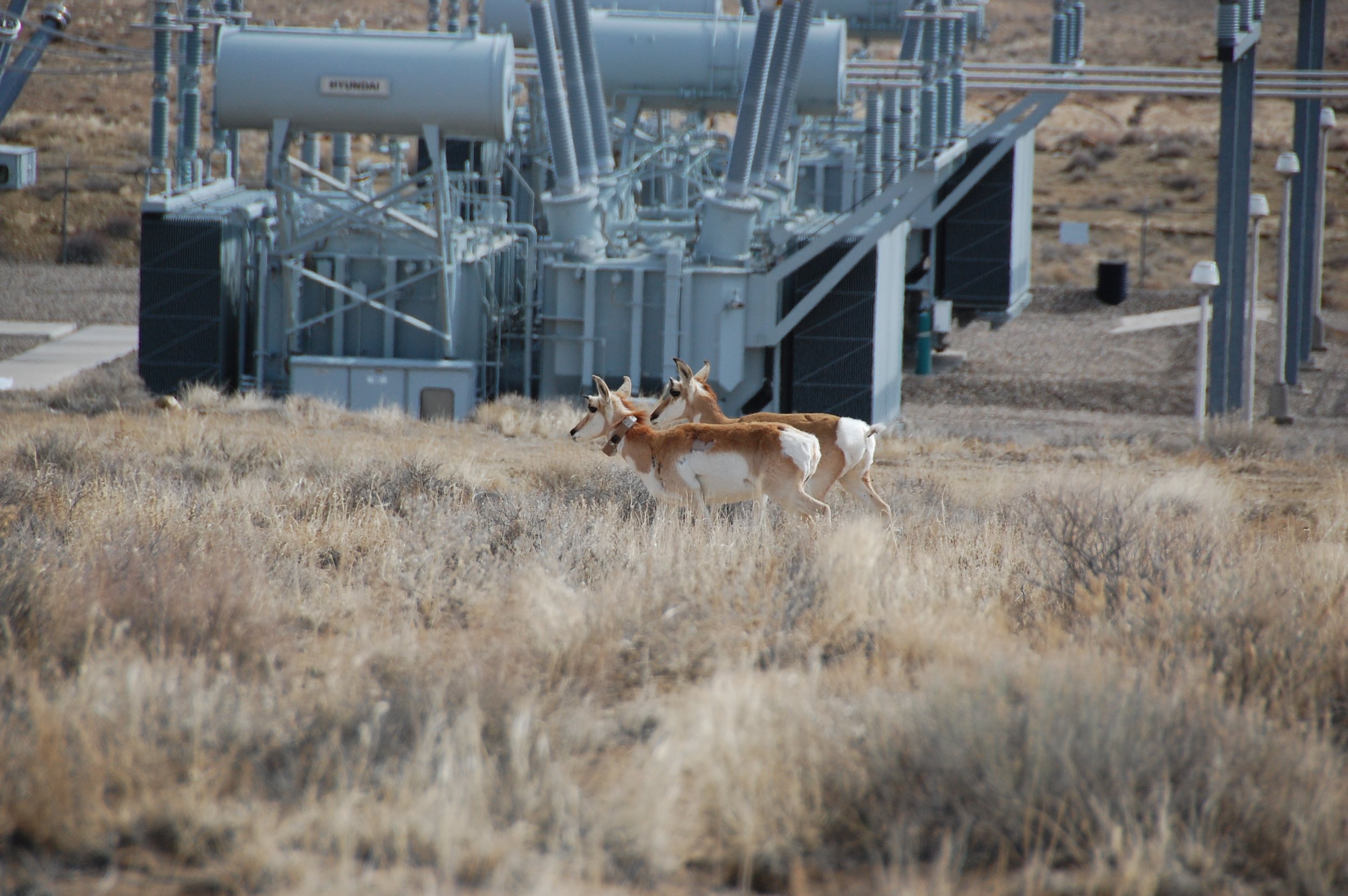
A collared and uncollared pronghorn walk near a power substation within the North Project Area. Photo by: Kevin Smith
---
In the Four Corners, we’re conducting a large-scale analysis of utility-scale solar energy (USSE) development’s impact on wildlife by closely monitoring pronghorns and other species over several years.
Our project has two primary goals: 1) To improve the understanding of how USSE development interacts with wildlife and 2) To develop methods and resources that can help practitioners identify and reduce wildlife conflict in their solar projects.
To make these assessments, we focused our study on two locations: a North Project Area just outside of Farmington, New Mexico, and a South Project Area in eastern Arizona. Solar developers have proposed new projects in both study areas. In the North Project Area, construction of San Juan Solar, a 200-megawatt USSE development, is underway and slated for completion in the fall of 2024.

San Juan Solar, a 1,100-acre development under construction in our North Study Area (New Mexico). Photo by: Aaron Facka

Concerns about the impacts that these facilities may have on ungulates typically fall into two categories. One, the fencing required to enclose the solar panels excludes previously available habitat potentially used by pronghorns, and two, they can create a barrier to both seasonal and daily movements.
Neither of these potential impacts are fully understood, and this knowledge gap makes it challenging for researchers, developers, and land managers to understand how to site these developments in order to minimize or mitigate impacts to pronghorns and other wildlife, including ungulates, carnivores, raptors, and others like prairie dogs and rabbits.
So, why deploy collars? After all, the process is both expensive and invasive for the animals involved, and other non-invasive monitoring techniques - such as visual surveys, remote cameras, or looking for ungulate tracks around the fencing - can inform the areas that animals are occupying to varying degrees, all while being much cheaper.
“The kind of individual location data that GPS collars can collect is impossible to get through other means,” explained the project’s principal investigator, Aaron Facka, PhD. “As solar projects are developed in our study areas over the next three years, we will use this granular data to assess the areas that individual pronghorns are both using and avoiding, how they are moving around the development fencing, and whether any of these behaviors change with development.”

A pronghorn of the Four Corners. Photo by: Kevin Smith
Additionally, we are testing the effectiveness of multiple non-invasive techniques in comparison to each other to see how well they detect pronghorns and document patterns of change associated with solar development. Using location data from the collars can help us better understand the pros and cons of these different detection methods.
For instance, if we learn from GPS data that collared pronghorns heavily utilize a particular area, but our nearby trail cameras fail to detect them, it sheds light on the biases of that non-invasive method. For much of the future monitoring efforts around utility-scale solar developments, it will likely be impractical for groups to deploy collars on animals due to the cost and time commitment, so developing cost-effective, non-invasive survey methods is important.
“With a rapidly increasing number of solar facilities being proposed and built, we’re hoping to match the rigor of research to the rate of solar development. This study is timely and important, and our results will be relevant to dozens of similar solar projects across the country,” says Michael Dax, Western Program Director at Wildlands Network.
Deploying these pronghorn collars was an important milestone for this project. Our team is looking forward to seeing a detailed picture of these animals’ reactions to a changing landscape.
Stay tuned for updates on our webpage here.
Collaborators:
A big thank you to our collaborators on this project who helped make this happen: Navajo Nation, Ute Mountain Ute, New Mexico Department of Game and Fish, New Mexico State Land Office, Bureau of Land Management – Farmington Field Office, GeoSystems Analysis, Solariant, LLC.
Funding:
This project is funded by the U.S. Department of Energy Solar Energy Technologies Office.
About the Solar Energy Technologies Office
The U.S. Department of Energy Solar Technologies Office supports solar energy research, development, demonstration and technical assistance to improve the affordability, reliability, and domestic benefit of solar technologies on the electric grid.
Learn more at energy.gov/eere/solar.