Check out a map of Arizona’s rouge shipping container border wall
Myles Traphagen has visited the construction sites of Arizona Governor Doug Ducey’s shipping container border wall numerous times since construction began in October.
“It was immediately apparent that the project was causing extensive destruction,” said Traphagen, Wildlands Network’s Borderlands Program Coordinator, who is based in Tucson. “I watched native Emory oak and alligator juniper trees being bulldozed as this 'junkyard wall’ snaked its way further and further through this landscape, which is designated critical habitat for the endangered jaguar.”
Using satellite imagery, GPS coordinates and on-the-ground reports, Traphagen diligently recorded the daily developments as the containers were trucked in and stacked double, starting at the western edge of Coronado National Memorial. View the map he created, below.
Since the project was carried out illegally by the State of Arizona on federal land, there were no accurate maps or specifications for the construction. Our map has been a valuable tool that has provided timely and accurate information to numerous interested parties.
On the morning of December 14 the U.S. Department of Justice filed a lawsuit against the state of Arizona demanding a halt to the project. The Center for Biological Diversity filed suit as well and included AshBritt the contractor that had been hired to build shipping container walls in Arizona at the taxpayer price tag of $124 million.
The U.S.-Mexico border wall constructed during the Trump administration threatens the Sky Islands, a binational region of immense biodiversity that is home to jaguar, javelina, white-tailed deer, black bear and many other species. The shipping container wall is no different — perhaps even more detrimental given that it has no gaps to allow the movement of smaller animals.
Drones have been powerful tools for mapping the border wall because they allow quick access to remote, rugged terrain. The birds eye view drones provide is a useful vantage point for documenting the destruction through photos and video. Furthermore, due to the navigational capabilities of these aircraft, drones can capture accurate GPS points that are then exported into a GIS system to rapidly produce maps. Video: Myles Traphagen/Wildlands Network
“The environmental consequences in regards to wildlife and wildlife migration and connectivity could not be more severe in this particular location,” said Traphagen in a recent interview with Democracy Now! The remarkable San Rafael Valley (where the shipping container wall is built) was spared border wall construction during the Trump administration and is one of the last intact mile-high grasslands that is not walled off at U.S.-Mexico border.
As of the afternoon of December 16, construction of the shipping container wall had ceased. Wildlands Network continues to monitor the situation along the border wall daily, not only at the shipping containers but across Arizona and New Mexico. In July, we released a report detailing sites along the U.S.-Mexico border that are in most dire need of environmental restoration.
“Stopping this destructive border wall that would have blocked crucial migration routes and connectivity for iconic species was a major victory in our tireless preservation of nature and large landscapes,” said Traphagen. “It was a brave, community-based group effort in defense of a remarkable landscape — a true gem of the Borderlands.”
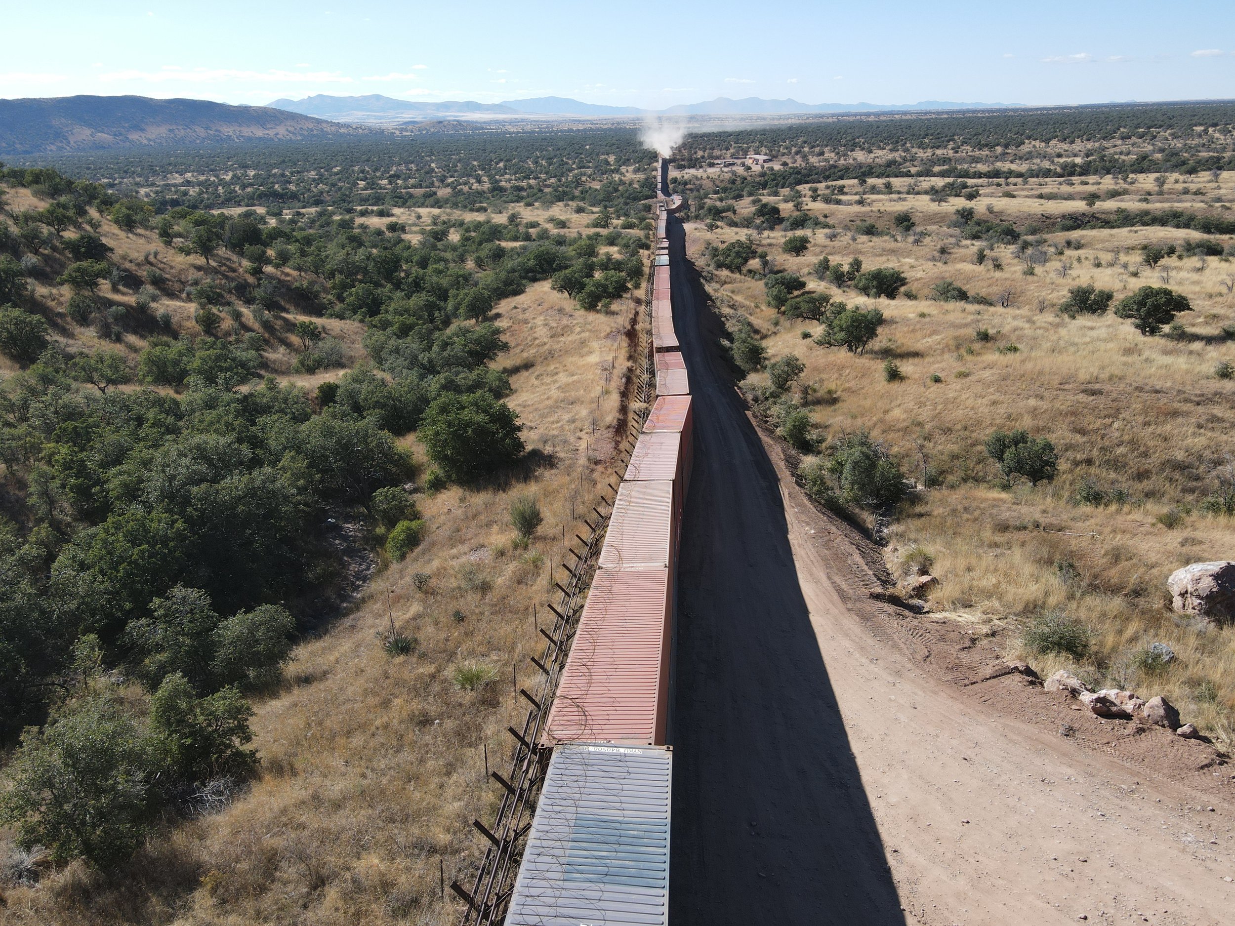
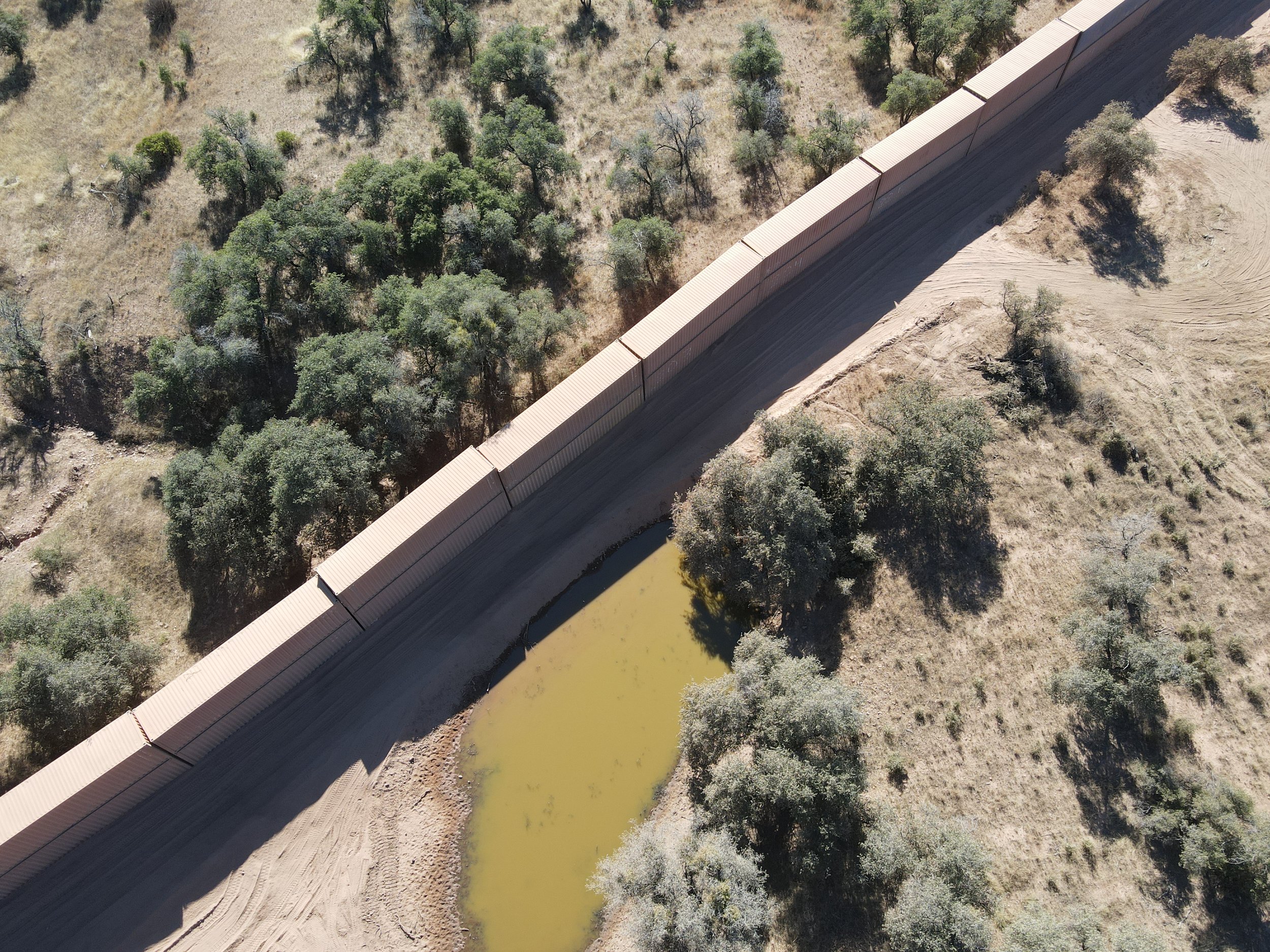
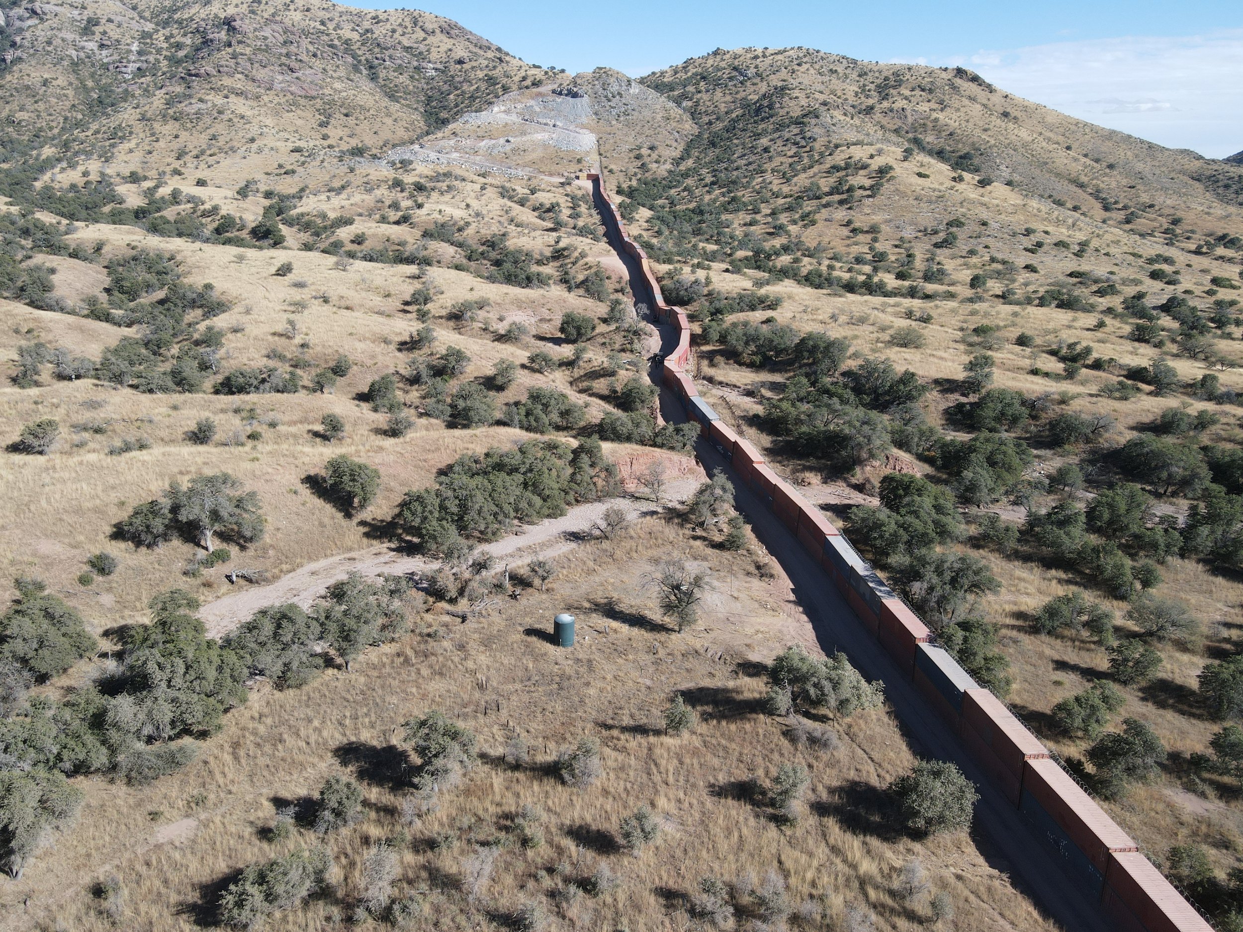
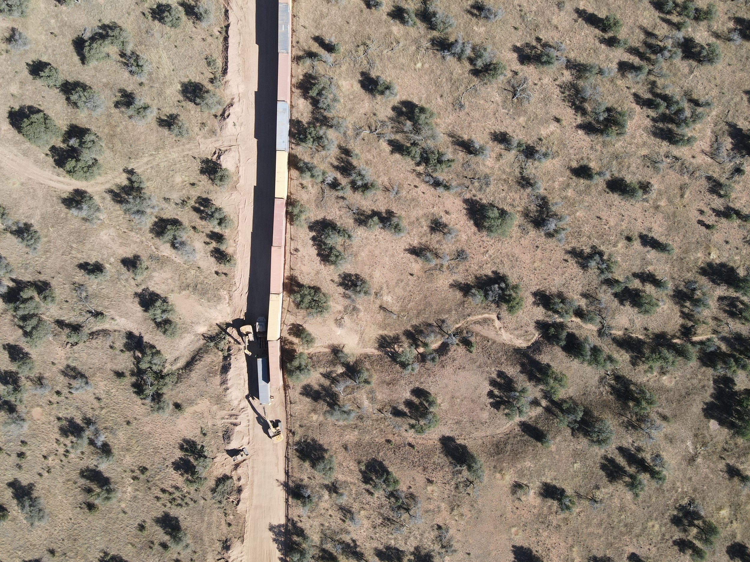
Photos: Myles Traphagen/Wildlands Network
Sign up for our e-newsletter to say informed of the latest developments in Borderlands restoration and our other efforts to protect biodiversity across North America.
January 18, 2023 UPDATE. Sierra Magazine published an article with additional information about the status of the wall.