Where Do Wildlife Crossings Go? A Peek Behind the Placement Process
A black bear and her cub play in their natural California habitat. Video by Pathways for Wildlife
It’s one of the most common questions we hear: How do you know where to put wildlife crossings?
The answer begins with trying to understand where, why, and how wildlife move.
With this understanding, we create a map—and a vision. At Wildlands Network, we don’t just look for spots where animals cross roads. We look at the big picture: how species move across entire landscapes, what interrupts that movement, and how we can reconnect the wild.
Here’s how we do it.
Step 1: Start With Wildways
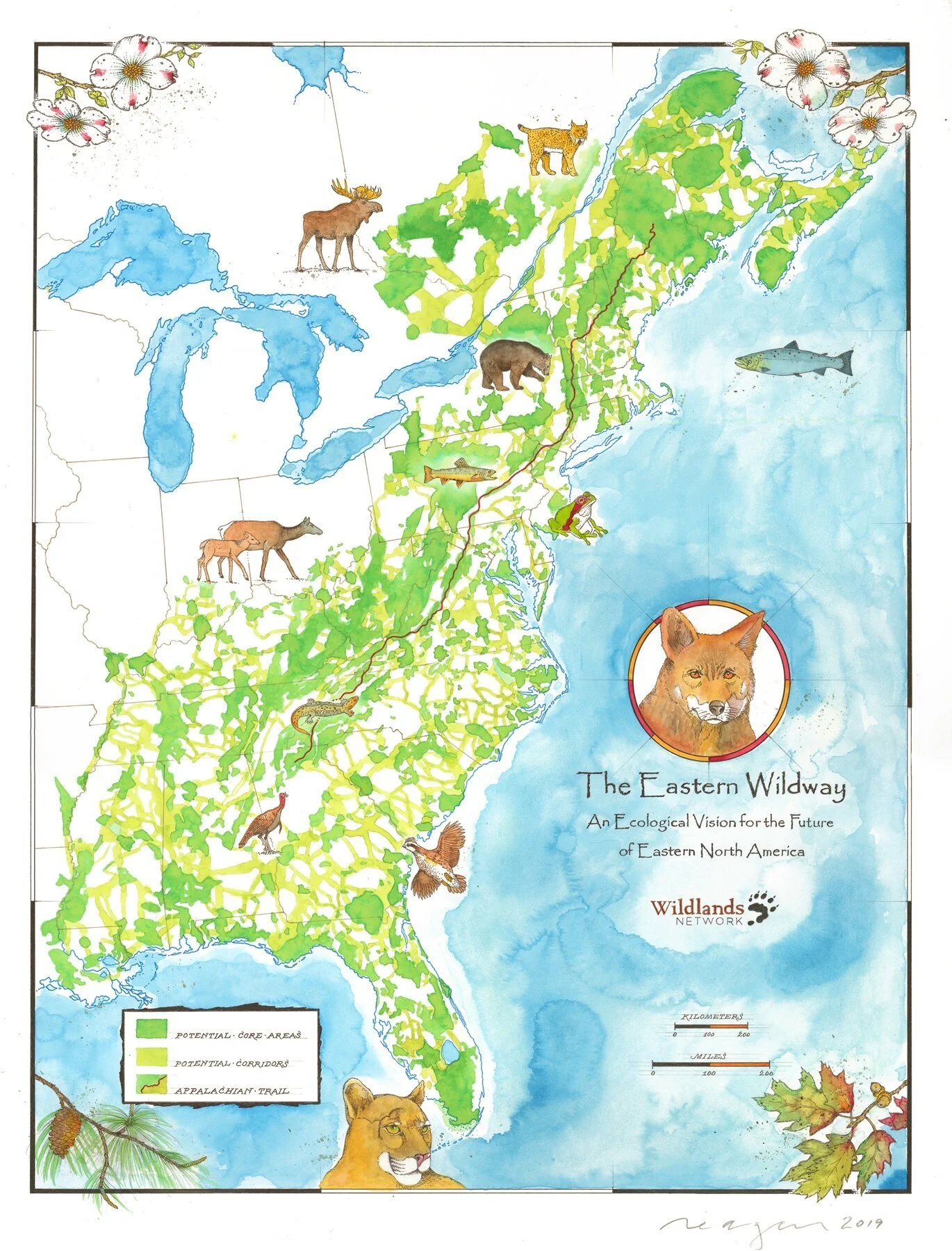
A vision of a connected landscape using our Eastern Wildway, painted by Michael Reagan. Map by Wildlands Network
Wildways are the foundation of our work—a network of connected habitats that stretch from Canada to Mexico. They’re like continental highways for wildlife, linking large, wild areas with the corridors animals use to travel, migrate, disperse, and adapt to a changing world.
We identify key habitat cores (protected or critical areas) and the corridors that connect them. Some of these paths are still functional, but many need help. That’s where wildlife crossings come in.
Step 2: Follow the Wildlife
Needing to traverse a busy highway to find food, water, and shelter for her family, the black bear and her cubs narrowly miss a collision while crossing. Video by Pathways for Wildlife
We then let the animals lead the way and the data tell the story. Using trail cameras, GPS collar data, DNA samples, and track surveys, we study how wildlife moves—whether it’s a mule deer migrating with the seasons, a mountain lion dispersing to new territory, or bighorn sheep navigating rugged terrain for food and water.
We also use advanced modeling to predict where species are most likely to travel across the landscape, especially where movement is essential for survival. More on our modeling techniques here.
Step 3: Find the Roadblocks

After colliding with a vehicle, this bear wasn’t so lucky. Photo by Pathways for Wildlife.
Once we have a baseline understanding of how and where animals move, we turn our attention to what’s in their way: roads.
We assess where roads intersect important corridors and habitat cores. Where those intersections exist, traffic volume is a helpful tool in identifying the most problematic areas:
Fewer than 2,500 vehicles/day: low impact on wildlife.
2,500–10,000 vehicles/day: high risk of collisions – this is where we find the most roadkill.
Over 10,000 vehicles/day: often a total barrier to wildlife, where animals avoid roads or never successfully cross.
We focus on roads where these pressures are greatest—and where safe crossings are most urgently needed.
Step 4: Pinpoint the Site
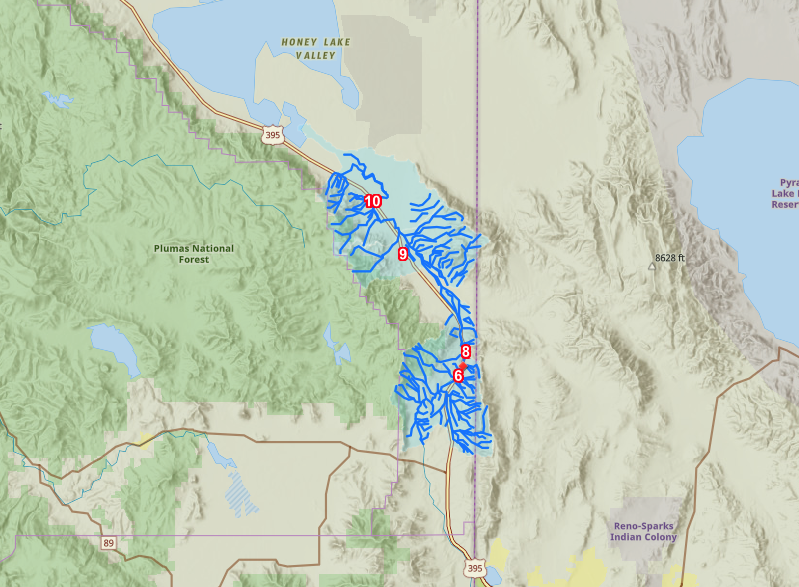
The map above is from Caltrans Wildlife Connectivity Barriers Map. Locations on US 395 were informed by Wildlands Network’s US 395 Road Ecology Study, conducted by Pathways for Wildlife. Caltrans’ priorities were identified in compliance with The Safe Roads & Wildlife Protection Act (2022- Friedman), which was co-sponsored by Wildlands Network and the Center for Biological Diversity. The identification of wildlife crossing priority sites in California will support black bears, mule deer, mountain lions, and other wildlife species.
Time to get specific. We often look for three key indicators when siting crossing locations:
Pinch points: narrow stretches where a particular type of habitat narrows and connects two larger wild areas (creating an hourglass shape). This can occur naturally or due to human development.
Roadkill hotspots: a section of road where wildlife roadkill is observed more frequently than surrounding stretches of road due to traffic volumes, road configurations (e.g. blind curves), or preferred wildlife habitat.
Barrier effects: high traffic volumes create such a large visible and audible disturbance that species may avoid a road completely or rarely try to cross, even if all other data indicate they should be moving across the landscape.
Using all this data and refined research, we zero in on the top 5–10 most critical sites where a crossing structure would have the greatest impact, resulting in fewer wildlife-vehicle collisions, increased wildlife populations, and better landscape-scale connectivity.
From Vision to Reality
The black bear and her cub can now access their home range safely across a highway using an underpass. Video by Pathways for Wildlife
Once sites are selected, we work closely with transportation agencies and partners to move from planning to construction. Our team supports every step—applying for grants, collecting species data, coordinating project meetings, working with land trusts, and ensuring communities stay informed and involved.
And we never forget the final, crucial piece: fencing. Without it, animals can bypass crossings altogether. Fencing helps them safely find the structures that reconnect their world.
This work is rooted in science, powered by partnerships, and guided by a belief that we can connect and restore the continent so that people and wildlife can thrive together. Stay tuned—next, we’ll share how animals actually use these crossings, and how we help them find their way.