How Does Water Interact With Solar Development to Affect Wildlife?
Our Wildlife Interactions with Renewable Energy Development (WIRED) project is studying the impact of solar development on wildlife movement. Ashley Jorgenson, our incredible summer intern, embarked on an important aspect of this project’s research this year: analyzing the influence of water on wildlife movement and its resulting impact on solar projects. “I’m deeply grateful to my colleagues for their mentorship and support this summer. Collaborating with this team provided valuable insights on the ways that solar development impacts pronghorn,” she shared. Learn more about her contribution to understanding and protecting pronghorn access to critical water resources below.
As I was out driving around our study area looking for collared pronghorns, I noticed water was visibly scarce even for this arid grassland. In June, when the monsoon season began, I watched dark clouds forming on the horizon, promising thunder, lightning, and, most importantly, rain. Especially in summer, rain was unpredictable in its location, duration, and frequency in the Four Corners region.
This sparked my curiosity: How do pronghorn survive in such a dry place? Do pronghorn, like the one in the video below, know where rain falls and pools? Perhaps most important for the purposes of our research, how might rainfall patterns and a pronghorn’s water needs interact with ongoing or future solar energy development that could affect their access to these vital resources?
A pronghorn drinking from a temporary water source in our study site in New Mexico.
Accessing Water in an Arid Climate
As part of our WIRED project, we decided to further explore water availability as a critical factor in landscape use and daily movement.
Previous research found that in addition to drinking freestanding water, pronghorn can obtain at least some portion of their water from the vegetation they forage on. Succulent forbs are the preferred food source for pronghorn, and the moisture content within these forbs are thought to be an important part of their overall water intake. However, during dry spells, plants hold less moisture, which means that even when there is abundant vegetation, water is still limited by how much moisture is present in the landscape.
Our two study sites, located in northern New Mexico and Arizona, are more arid compared to some other regions where pronghorn live. How pronghorns obtain their water isn’t fully understood.
If pronghorn were to rely on vegetation with high moisture content, this type of vegetation might also be greater in areas near water. Alternatively, if pronghorn need freestanding water to drink, then knowing those locations could tell us which water sources pronghorn prefer or avoid and how they travel to acquire it. This knowledge could help us to better understand how current, or future, solar projects would affect animal’s ability to access water and even their success in reproduction.
Pronghorns should move to and spend more time in places with water, especially during times of the year with hot and dry conditions. These conditions are most common during the summer, coinciding with the time in which female pronghorn typically give birth and nurse their young, who are born in May or June.
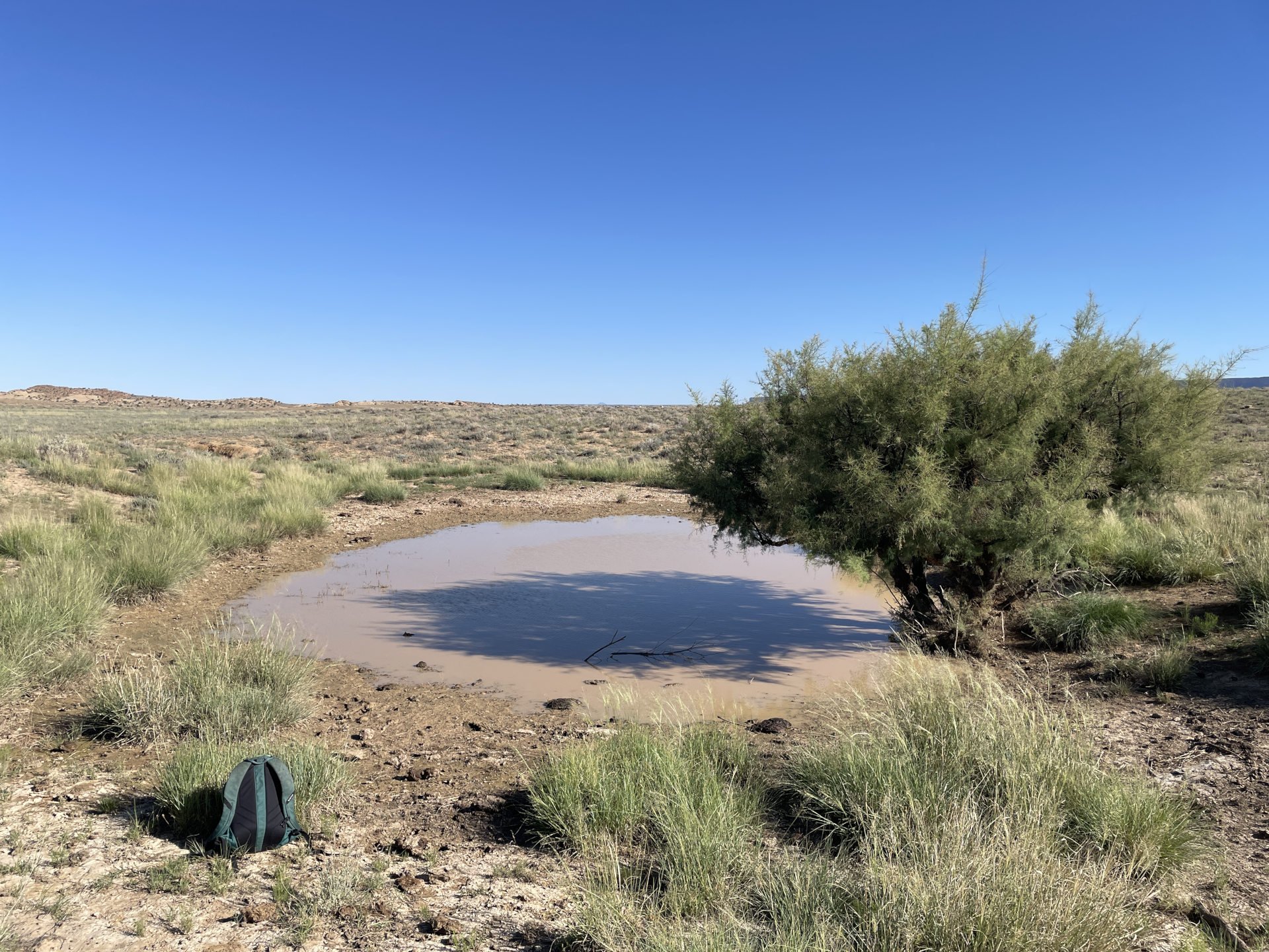
Water soaks the ground at the northern project area after an intense downpour near Farmington, New Mexico in summer of 2024.
Understanding Water’s Role in Pronghorn Movement
To understand how solar development may impact pronghorn water use, we first needed to know how water is distributed throughout the landscape by mapping potential water sources and determining how often, and for how long, they hold water.
Remotely sensed data gives us some indication of where water is likely to occur, particularly for small-scale water features such as cattle tanks. However, this data does not guarantee the presence of water, nor does it indicate whether wildlife can access it or how often they do. Although we had some geographic information for water features, we needed to conduct extensive ground truthing of the study areas to verify conditions in the field.
To address this, we developed a survey to sample potential water sources throughout the study area and document characteristics of each location. These surveys help us understand which water sources are permanent, which ones have water only after high precipitation, how long they retain water, and whether fencing is present that could affect pronghorn access.
As with any study, comparability within and among sites or times is crucial to making meaningful inferences. Early on in our survey development, we realized that different surveyors referred to water sources by different names. This posed a potential problem when analyzing the data or forming recommendations for others to incorporate. For instance, one surveyor may call a water source a “stock tank” based on their knowledge of types of water sources, when it was technically a spring-fed pond.
To address this, we developed a standardized document which defined types of water sources and fences. This guide not only ensures we are being consistent in our own data collection efforts, but also could guide on other projects in other regions in the future.
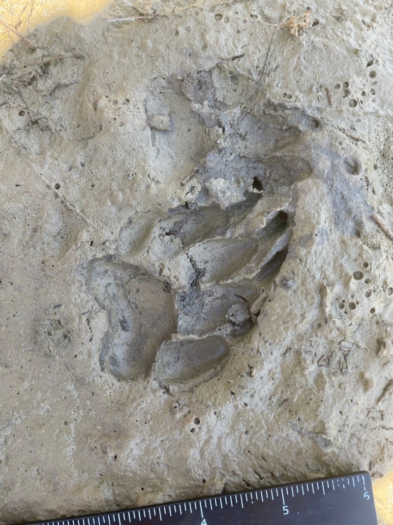
A badger footprint located along the edge of a temporary water source near.
Pronghorn tracks leading to water.
Additionally, we documented tracks adjacent to each water source to better understand the various species that are actively using these sources like in the photos above.
We began the process of surveying the water sources at both study sites in June. Between the two study sites, we surveyed 92 potential water sources, which included earthen dams, stock tanks, windmill pumps, reservoirs, spring-fed pumps, ponds, and guzzlers. The amount and type of water sources varied greatly between the two project areas.
The Southern project area appeared to have more man-made and structurally intact sources, like stock tanks and windmill pumps, while the Northern project area had a higher number of earthen dams compared to other water sources. Out of the 55 potential sources in the Northern project area, 20 did not have water upon our first survey. After two heavy rainfall events in late June, we observed a number of earthen dams and ponds retaining water that had been previously dry for many months.
A small depression where water collects after heavy rainfalls.
The same spot minutes later. The water quickly dries after rain dissipates.
Mapping the Potential Impact of Solar Development on Pronghorn Water Access
Ultimately, we can use the specific site information and general water availability in a pronghorn’s home range or across a study area to understand the value of water to the populations. For example, do female pronghorns visit a specific preferred water source routinely or do they simply use the water that is closest to the best forage? Does a home range with more water cause females to move less often or less far? Do periods of low water availability cause restrictions that could be blocked or destroyed by solar development?
By combining the water sources we mapped with GPS data we’re gathering from collared pronghorn, we can begin to understand how water influences pronghorn movement and space use.
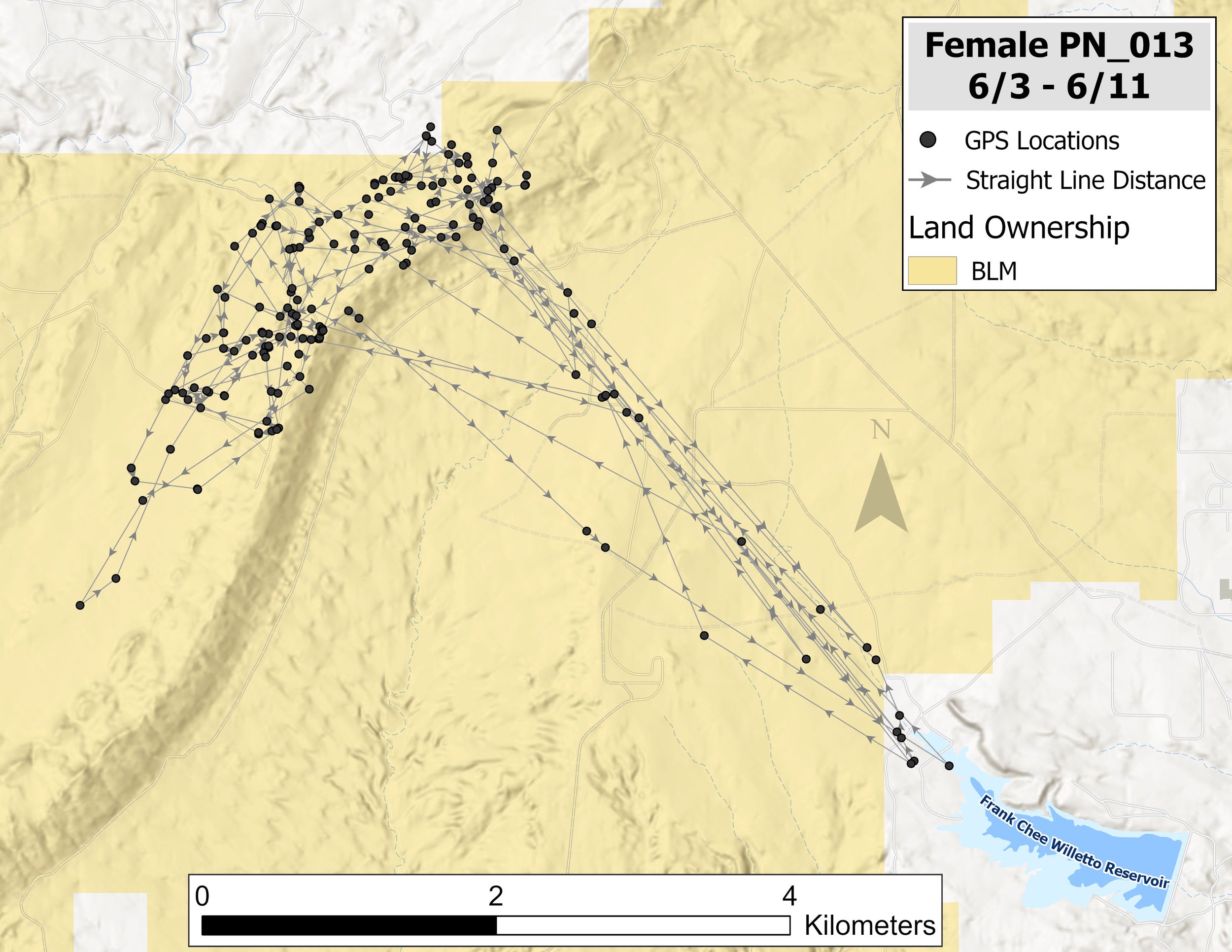
GPS data showing a female pronghorn’s movement to and from a water source. If a solar development were here, it could potentially block pronghorn access to water. Map by Wildlands Network.
In the middle of June when the temperatures soared and there was very little rain, we observed female pronghorn making trips to locations with permanent water daily – often times along very similar paths as the map above shows. In at least one instance, the path the female took to water crosses a potential solar fence line. If the fence is built, it could block this permanent water source critical to the pronghorn’s survival, particularly during the dry season.
While this example shows animals moving to a clear body of water, other movements might be less obvious if we do not know water is there. Movement data is more significant when we understand why wildlife are routinely moving to certain areas, which is why it’s so important to identify whether water is available in the daily movement paths we’re gathering. This will also help us understand how future solar developments may impact these animals and their access to resources.
Between our surveys and on-the-ground data collection, this study is aggregating information across movement patterns in every season, movement incentives, resource access, and changes based on climate conditions to identify and mitigate the impacts of solar development on wildlife movement. This information will continue to inform solar siting and protect access to water for pronghorn and many other species for years to come.


