Mapping the East: Implementing the Eastern Wildway Vision
“The beauty of the Eastern Wildway is that it’s an optimistic vision of what life could be. In a world full of dystopic ideas, this map is a future that we want to live in; a guide to a world where wildlife can thrive among humans.”
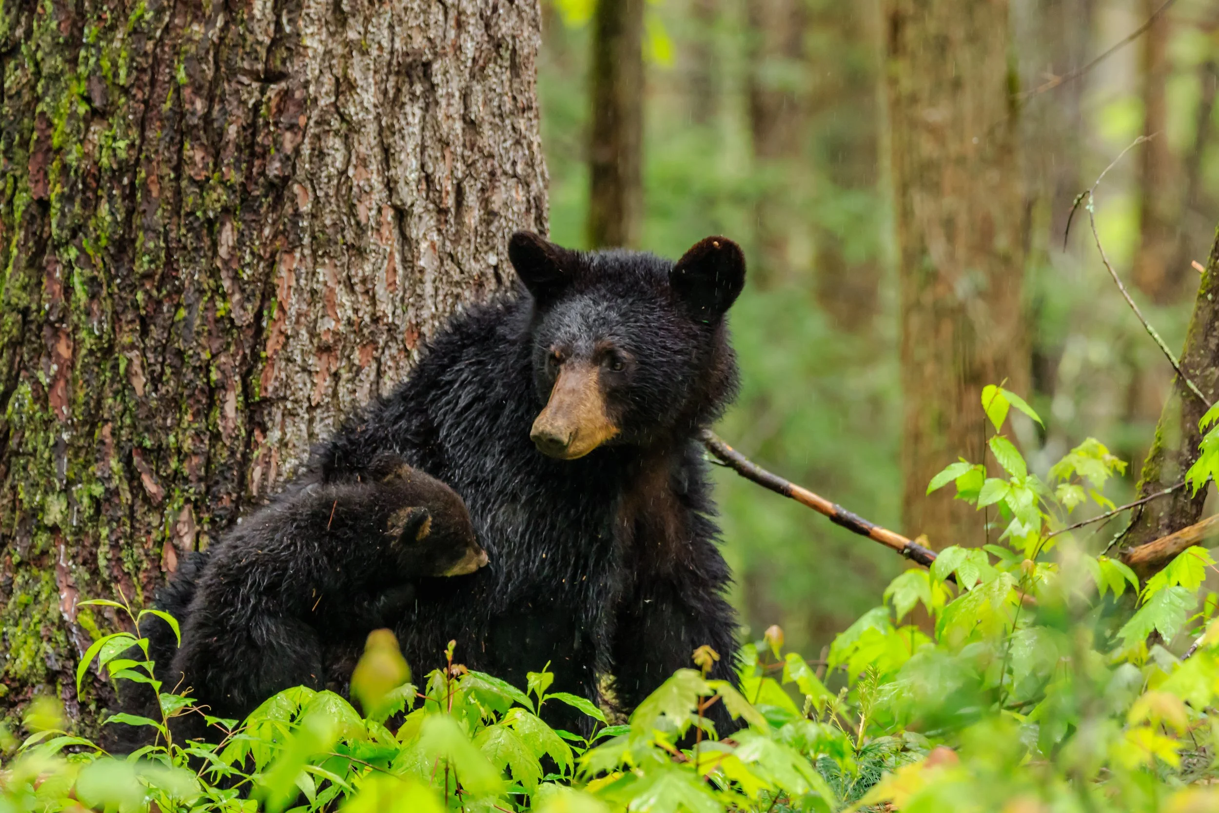
Red wolves, elk, alligators, rattlesnakes, raccoons, opossums, flying squirrels, lynx, wolves, and black bears are just a few of the abundantly biodiverse wildlife inhabitants native to North America’s eastern regions.
Since the waves of European and other settlers arrived, the eastern portion of “Turtle Island*,” aka North America, has experienced some of the densest human population growth in the US and Canada. Many habitats and wildlife populations suffer in the wake of resulting “development” designed without concern for wildlife needs and disregard for landscape connectivity.
Is it possible, then, for humans and wildlife to co-exist in eastern North America? Wildlands Network and our partners believe: “Yes!”
Since its beginning, Wildlands Network’s mission has been to restore wildlife populations and reconnect fragmented habitats by mapping landscapes, wildlife movement patterns, and key habitat cores linked by corridors.
After years of consolidating and analyzing wildlife and ecosystem data across the scientific community, in 2019 we created a foundational guideline of an ecologically connected North America: the Eastern Wildway.
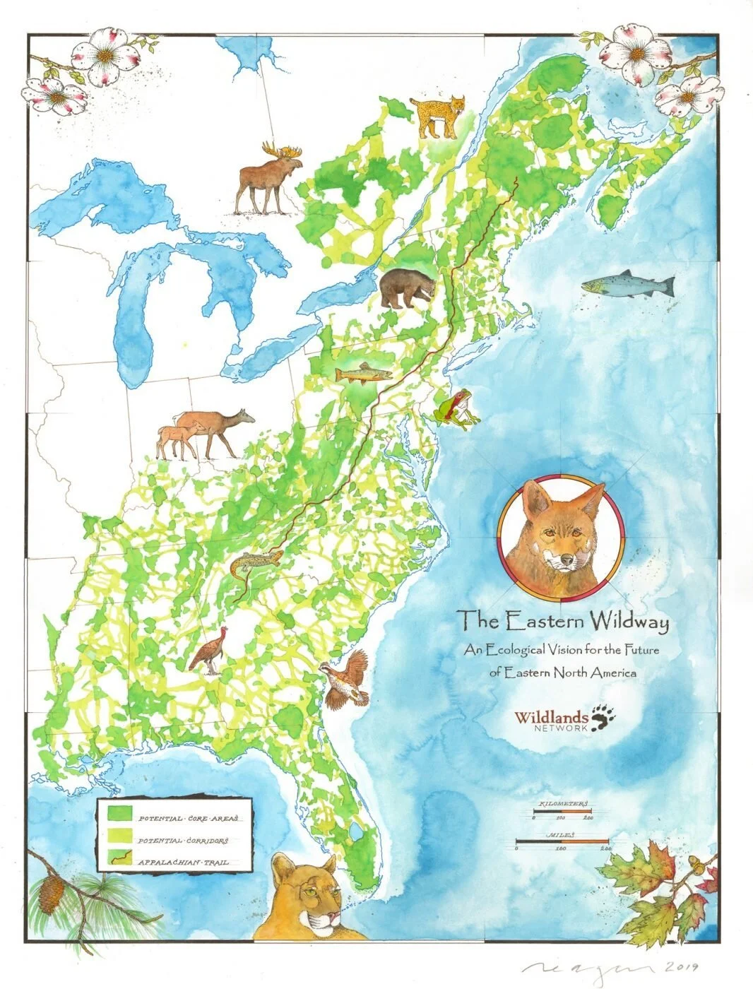
Our ambitious Eastern Wildway vision demonstrates a Half-Earth reality where 50% of the land and waterways are conserved and connected. This 50% is intended to be the most vital half of the land for wildlife to thrive.
We are implementing this vision by bringing big-picture mapping to regional-scale partnerships in states and provinces, working towards one of the stepping-stone goals to Half-Earth, the “30 by 30” initiative outlined in the Global Biodiversity Framework. The aim is to conserve 30 percent of land and water by 2030.
Since 2019, we’ve had been making steady progress as the Wildway provides direction to 30 by 30 and Half-Earth models and promotes landscape-level approaches to conservation through connectivity. For example, the Eastern Wildway map is being used in several exciting ways in New York, one of the most populous areas of North America.
“We’re bringing the Eastern Wildway vision to life on the ground. Working with partners and focusing our mapping and analyses on regional landscapes results in action on specific projects and conservation successes. Together, we are forging ahead to achieve 30 by 30 connectivity goals for wildlife.”
New York
New York has established itself as a leader in the 30 by 30 movement, starting with a landmark bill passed in 2022, which we actively supported. Our implementation of the Eastern Wildway in New York is led by Ed Marx, our Northeast Project Manager. Alex Vanko, our GIS Analyst, created a state-level conservation priority index and conservation priority map, which assigns a “score” based on metrics of wildlife habitat value, connectivity value, parcel size, and proximity to already protected lands.
This map includes several relevant data layers and expands on earlier work of staff at New York State Office of Parks, Recreation, and Historic Preservation Parks (OPRHP), which identified the most valuable natural areas in the state. We have a data-sharing agreement with OPRHP, and the wildlife habitat value metric is now directly based on the OPRHP Biodiversity Indicator Tool that Parks created a few years ago.
“Right now, our team is actively working on the analysis and mapping process for the state in consultation with state agencies,” says Ed Marx. “Our goal is to implement the Eastern Wildway in New York’s 30 by 30 plan.”
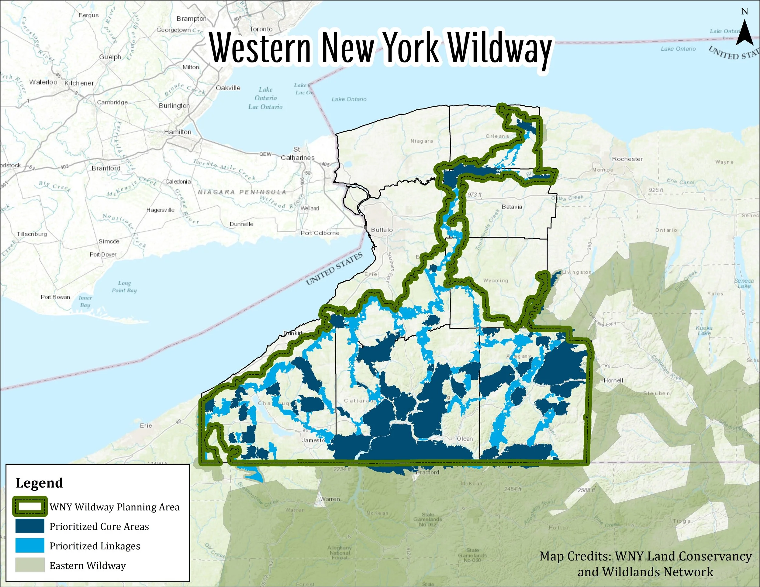
In addition to making 30 by 30 a reality, the Wildway vision has inspired others to develop regional-scale Wildways. In 2020, Ed presented our work to the staff and board of the Western New York Land Conservancy (WNYLC), resulting in the creation and adoption of their Western New York Wildway, mapping out their landscape parcel by parcel to bring the map to a county level.
They identified 35 core areas and linkages, connecting across the state line to the Allegheny National Forest and the Eastern Wildway's large central Pennsylvania core region. Other connections reach to the Great Lakes and Finger Lakes regions with plans for further links to the Adirondacks. This map is a key component of their 5-year plan, already providing results like the conservation of the 200-acre Allegany Wildlands Project.
"Western New York is my home," says Marisa Riggi, Acting Executive Director of the Western New York Land Conservancy. “From the rolling, thickly forested hills of Chautauqua and Cattaraugus County to the shores of Lake Ontario, Western New York teems with beauty and wildlife. But it is also one of the least protected regions of our state. We are developing the Western New York Wildway to ensure that more of our region is protected and connected for the betterment of the people and wildlife who call it their home."
Ed and Marisa shared the results of our collaboration with over 100 other state Land Trusts at the Land Trust Alliance New York Rally in May 2023.

Ed and Marisa presenting on our collaboration, the Western New York Wildway, at the New York Land Trust Rally in May 2023.
New York is a promising model for our work with other states. While we’re excited about this progress, our work continues, guided by continued refinement of the Eastern Wildway map as we collect more data and input from regional partners.
The Eastern Wildway is bigger than Wildlands Network – it’s a vision for the hearts and minds of all communities in the East and beyond. We encourage all to incorporate wildways into their vision for a connected future.
With your continued support and partnership with allies across the Eastern Wildway, Wildlands Network is creating a world in which life, in all its diversity, can thrive.
Click here to view an interactive version of the Eastern Wildway map.
* Turtle Island is a name for North and Central America used by Indigenous communities. As recounted by Robin Wall Kimmerer in her outstanding book “Braiding Sweetgrass” (which she adapted from oral tradition and Shenandoah and George, 1988):
“Skywoman bent and spread the mud with her hands across the shell of the turtle. Moved by the extraordinary gifts of the animals, she sang in thanksgiving and then began to dance, her feet caressing the earth. The land grew and grew as she danced her thanks, from the dab of mud on Turtle’s back until the whole earth was made. Not by Skywoman alone, but from the alchemy of all the animals’ gifts coupled with her deep gratitude. Together they formed what we know today as Turtle Island, our home.”